Capital City for Sweden Explained: A Practical Guide
Contents
A common mistake is to think of Stockholm as just a list of palaces, museums, and old streets. People often confuse Sweden’s capital with its other major cities. Stockholm is the seat of government, the parliament, and the monarch. It’s also a large city built across islands between Lake Mälaren and the Baltic Sea. That matters for visitors because royal and cultural sights show its identity. Its political and administrative roles define its status as the capital.
If you’re looking for the capital city for Sweden, the answer is Stockholm. But the full picture is broader. The city’s islands influence how people get around. Gamla Stan reveals part of its historic character. The Riksdag, Government Offices, Stockholm Palace, and Stockholm City Hall all show how national power and civic life are concentrated in a small area.
Key Takeaways
- Stockholm is Sweden’s national capital and the seat of the national government, parliament, and monarch.
- The city stands across 14 islands, linking Lake Mälaren with the Baltic Sea and shaping transport, views, and neighbourhoods.
- Stockholm is different from Gothenburg and Malmö: those are major Swedish cities, while Stockholm is the country’s political and royal centre.
What Is Sweden’s Capital City?
Stockholm’s national role
Stockholm is the capital of Sweden and the seat of the government, parliament, and monarch. That makes the city politically important even where no landmarks are visible. Its importance comes from the institutions that operate there, not just the places tourists take pictures of.
The Government Offices of Sweden coordinate the national government work from Stockholm. The Riksdag is Sweden’s national parliament. These institutions are useful to note because they help distinguish a capital from a large regional or commercial city.
Stockholm Palace stands for the Swedish monarchy and is part of the city’s royal landscape. It’s located in the historic center, but the monarch’s presence doesn’t mean Stockholm is only about royal tourism. Government work, parliament, administration, culture, and daily urban life all overlap in this area.
Why the capital is more than a landmark list
A capital city combines national decision-making, public administration, symbolic institutions, and civic spaces. Stockholm City Hall, the Riksdag, Stockholm Palace, and the Government Offices of Sweden each illustrate a different part of that role.
- Stockholm Palace connects the city with Sweden’s monarchy and royal residences.
- The Riksdag represents national parliamentary work.
- The Government Offices of Sweden represent the administrative side of national government.
- Stockholm City Hall shows the city’s civic identity rather than the national government alone.
- Gamla Stan provides the historic core, while government and cultural districts continue beyond the old town.
Stockholm’s government institutions make the city Sweden’s political capital. The capital’s visitor appeal grows from that institutional setting rather than replacing it.
How Stockholm’s Islands Shape the Capital
Fourteen islands and two bodies of water
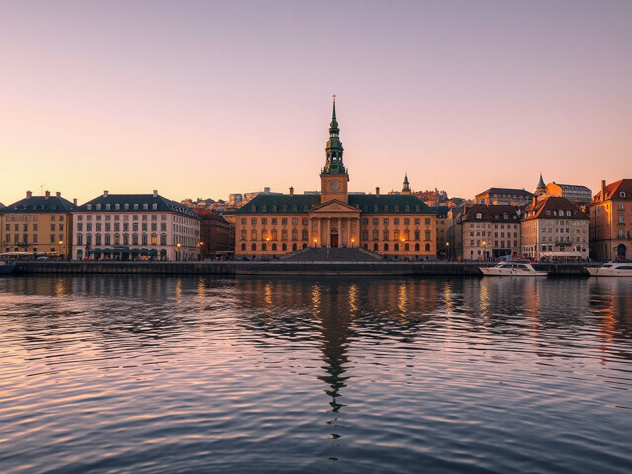
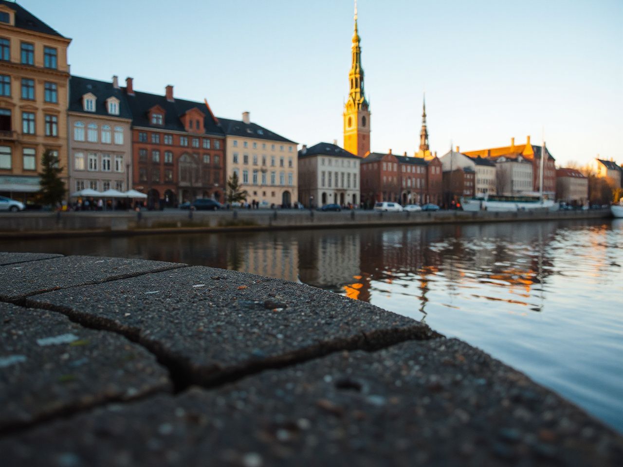
Stockholm is built across 14 islands, and an archipelago of about 30,000 islands extends into the Baltic Sea. The city also connects with Lake Mälaren, so water is not a decorative edge around Stockholm; water is part of its structure.
The island geography influences how neighborhoods meet. Streets, bridges, waterfront paths, ferries, and public transport routes link districts that might seem separate. A map makes the central area look compact, but a short journey could involve a bridge, a change of transport, or walking along uneven historic streets.
The Baltic Sea and Lake Mälaren give Stockholm two different geographic relationships. Lake Mälaren lies to the west of the central city. The Baltic Sea opens the city toward the coast and archipelago. The result is a capital with urban districts and open water appearing within the same visit.
Getting around central Stockholm
Visitors can move around central Stockholm by walking, public transport, and water-based connections. The most sensible choice depends on the district, weather, footwear, and how much time you have between visits. A route that looks easy on a map may feel different in rain, cold, wind, or on polished surfaces near the water.
- Walking: useful for connecting Gamla Stan with nearby civic and waterfront areas, though historic streets can be uneven.
- Public transport: practical when water, bridges, or longer district connections make walking inefficient.
- Ferries and boats: helpful for understanding the island geography and reaching waterfront areas, subject to the service available on the day.
- Route planning: check the departure point carefully because a stop on one island may be farther from the next attraction than the map suggests.
Stockholm’s central districts are accessible, but accessibility doesn’t mean effortless travel. Comfortable walking shoes matter more than a packed sightseeing schedule. This is especially true if your plan includes Gamla Stan, Djurgården, and waterfront routes on the same day. Practical lessons in this guide to avoiding walking-shoe mistakes apply to city travel well beyond New York.
Winter and outdoor activity risks
Stockholm’s water and cold-season setting can tempt visitors into treating frozen waterways as ordinary walking routes. That’s a serious mistake. Ice conditions can vary, and an attractive surface isn’t proof it can support a person.
Tour skaters are required to carry spikes and use long skates. This requirement signals that tour skating involves specific equipment and judgment. It’s not just casual sightseeing. Visitors should follow local guidance and use organised activity providers if they lack the skill to assess changing ice.
Stockholm’s Historic, Royal, and Civic Districts
Gamla Stan: the historic core
Gamla Stan is Stockholm’s historic core and a natural starting point for understanding how the capital developed around water and civic institutions. The old town contains narrow streets, historic buildings, and Stockholm Palace. But it shouldn’t be mistaken for the whole capital.
Gamla Stan works well as an orientation point because several major themes meet there: monarchy, historic urban form, tourism, and access to other central islands. Give the district time rather than rushing through it for photographs. Uneven paving, crowded passages, and changing weather can make a short walk require more attention than its distance suggests.
Stockholm Palace and the monarchy
Stockholm Palace is one of the clearest landmarks for explaining Sweden’s royal connection to the capital. Its location in Gamla Stan places monarchy within the historic city. Other royal residences connect the monarchy with the wider Stockholm area.
A palace doesn’t mean every nearby building is a royal institution. Visitors should distinguish between ceremonial and symbolic royal sites and the government offices and legislative work done by the Riksdag. The ceremonial role is different from the day-to-day work of government.
The Riksdag and Government Offices of Sweden
The Riksdag and Government Offices of Sweden show why Stockholm serves as Sweden’s political and administrative centre. They are important institutions, so understanding what each does can be more informative than just passing by a building. Their roles are key to the city’s status.
The Riksdag is Sweden’s national parliament. The Government Offices of Sweden support the national government administration. These roles are separate, and both are important in explaining Stockholm’s status as the capital.
Government buildings often have access rules that differ from public museums and outdoor streets. Always check official visitor info before planning a tour. Don’t assume you can enter a government building just because it looks important or tourist-friendly.
Stockholm City Hall and the wider civic landscape
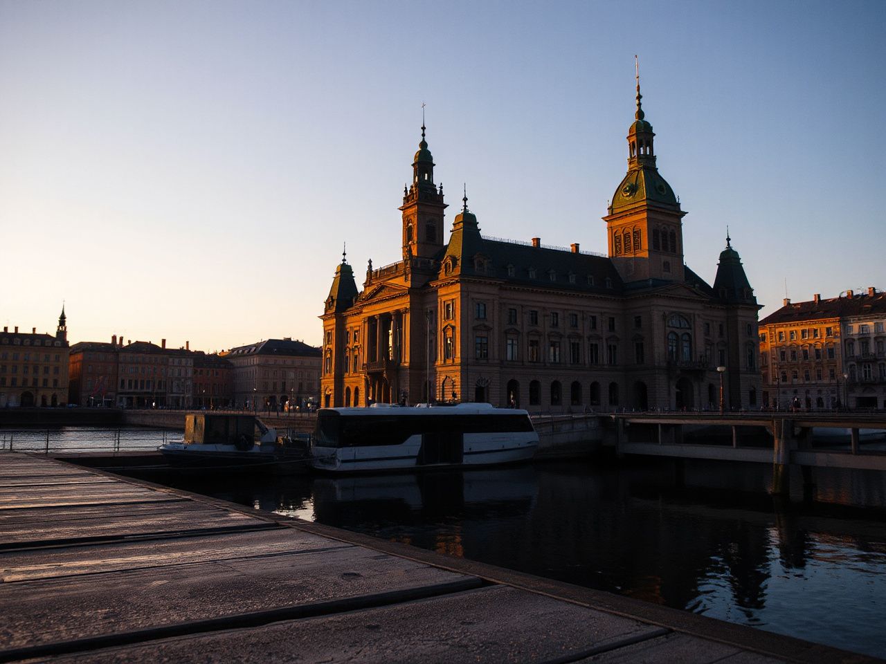
Stockholm City Hall shows the city’s local civic identity. It belongs to the municipal landscape. The Riksdag and Government Offices of Sweden represent national functions. Seeing these buildings together paints a clearer picture than treating every official-looking structure as part of the same institution.
The capital’s cultural districts also extend beyond Gamla Stan. Djurgården, waterfront areas, museums, public spaces, and neighbourhoods across the islands show that Stockholm is an inhabited city rather than a preserved historic set. Historic areas are maintained as working parts of the urban environment, where visitors share streets and public spaces with residents.
Stockholm Compared with Sweden’s Other Major Cities
Stockholm and Gothenburg
Stockholm is Sweden’s national capital, while Gothenburg is a major Swedish city with its own urban character and regional importance. A first visit to Stockholm makes more sense if your priority is Sweden’s monarchy, national parliament, government institutions, historic core, island geography, and central cultural districts.
Gothenburg may suit a trip built around a different city atmosphere and a western coastal setting. The key point is that one city doesn’t replace the other. They serve different travel aims, and Gothenburg isn’t Sweden’s national capital.
Stockholm and Malmö
Malmö is a major Swedish city, but it isn’t the capital. Its location in southern Sweden gives it a different regional context from Stockholm. Stockholm sits among Lake Mälaren, the Baltic Sea, and the Stockholm archipelago.
Choose Stockholm for a clear introduction to Sweden’s national institutions and royal landscape. Malmö is better if southern Swedish geography and regional connections are important for your plans. A trip focused on Stockholm isn’t a complete survey of Sweden’s regions.
Which city should you choose for a first visit?
For a first visit to Sweden, Stockholm is the straightforward choice if you want the capital’s political, royal, historic, and island settings in one place. The city also provides a strong introduction to Swedish geography because water and connected islands influence the urban experience.
- Choose Stockholm for national institutions, Stockholm Palace, Gamla Stan, Djurgården, and the capital’s island layout.
- Choose Gothenburg for a visit centred on a different major Swedish city and western coastal surroundings.
- Choose Malmö for southern Swedish geography and a city experience separate from the capital.
- Combine cities only when the additional travel fits your available time and transport plan.
Families can also use Stockholm as a base for a wider trip. Planning should account for weather, water crossings, walking distances, and each traveller’s needs. The practical planning framework in this Sweden family vacation guide can help organize those decisions. It prevents reducing the country to just one city.
Stockholm Compared with Oslo and Helsinki
Three northern European capitals, different settings
Stockholm, Oslo, and Helsinki are all northern European capitals, but each has a different physical setting and national role. Stockholm is characterized by its 14-island structure, its link with Lake Mälaren and the Baltic Sea, and its concentration of Swedish royal, parliamentary, governmental, and civic institutions.
Oslo and Helsinki shouldn’t be treated as interchangeable versions of Stockholm. Their national institutions, city layouts, shorelines, and visitor routes belong to their own countries. The useful comparison is how geography and government meet in each capital, not ranking them by a single sightseeing standard.
Stockholm’s island geography often makes water a visible part of an everyday journey. This gives the city a different feel from a capital whose main points are arranged around another coastline, bay, or inland route.
Readers planning several Scandinavian capitals can use the complete guide to Scandinavian national capitals to keep country, city, and institutional roles separate. That helps prevent a common planning mistake: assuming similar northern climates mean similar transport, geography, or sightseeing patterns.
Cost, Planning, and Practical Expectations
Is Stockholm expensive to visit?
Stockholm can seem pricey compared to other Swedish destinations. But the cost of a visit depends on accommodation, meals, transport, admissions, and paid activities. No single city label can tell you what your own trip will cost.
The capital’s concentration of landmarks can help you plan efficiently. Walking between nearby districts may cut down on transport, while a ferry or public transit might save energy when water separates your stops. A careful route is more useful than assuming a low-cost day means walking everywhere.
- Group nearby sights by island or district.
- Check official opening and access information before travelling across the city.
- Leave room for weather-related transport changes.
- Balance paid attractions with public streets, waterfront areas, and civic views.
- Keep a separate allowance for food and transport rather than treating the whole day as one expense.
For planning that covers more than Stockholm, this Sweden trip-planning guide for 2026 can help place the capital within a wider route. Stockholm deserves its own time because its political and geographic identity can’t be reduced to a quick stop between other destinations.
Preservation and everyday use
Historic areas like Gamla Stan are preserved while still being active urban districts. That means visitors share streets, bridges, public spaces, and transport routes with residents and workers. Preservation is visible in buildings and street patterns, but it also depends on visitors respecting access limits, signs, and public space.
Royal and civic landmarks are kept as part of public life, not just as scenery. Follow official instructions at Stockholm Palace, the Riksdag, Stockholm City Hall, and other formal sites because access can vary from one place to another.
The official website of the Swedish Royal Court offers information about royal sites and the monarchy. Government and parliamentary details should come from the official institutions rather than assumptions based on a sightseeing map.
Planning for outdoor skill and danger
Stockholm is an urban capital, but water, islands, exposed shorelines, and winter conditions can pose outdoor risks. Visitors who usually focus on museums and cafés should still check footing, weather, route exposure, and the skill needed for activities on or near ice.
Tour skating needs particular care because long skates and spikes are required. Those tools don’t eliminate the need for local knowledge or judgment. A visitor who can’t assess ice conditions shouldn’t treat a guided or marked route as permission to go alone.
The same principle applies to city walking. Someone carrying luggage, moving through rain, or crossing slick surfaces has a different risk profile from someone taking a short dry-weather stroll. You should choose routes that match your balance, footwear, daylight, and willingness to slow down.
A Simple First-Visit Plan for Stockholm
Start with the capital’s structure
Start by identifying Gamla Stan, Stockholm Palace, the Riksdag, Stockholm City Hall, Lake Mälaren, and the Baltic-facing waterfront on a map. This gives you a mental framework before individual attractions compete for attention.
Stockholm’s map is easiest to understand when you see the city as connected islands rather than one uninterrupted central district. That basic orientation helps explain why bridges, ferries, and public transport matter.
Match each day to a manageable area
Keep the first route concentrated. Pair Gamla Stan with nearby royal and parliamentary landmarks, then plan another part of the visit for Djurgården and cultural sites. The exact order should follow opening information, weather, and available transport on the day.
A manageable route protects the quality of your visit. Racing from one island to another can turn a city with clear geographic character into a series of missed connections and rushed photos.
Build in a weather and transport plan
Stockholm’s water exposure means conditions can influence comfort even when sights look close. Carry a backup route, check transport departures, and stay flexible enough to replace a waterfront walk with an indoor visit if surfaces or weather turn unpleasant.
Travelers crossing borders during a broader Nordic trip should separate national travel rules, transport planning, and local sightseeing. The practical differences discussed in this Sweden and Norway border guide are useful when Stockholm is part of a longer regional itinerary.
Use landmarks to understand, not just collect
At Stockholm Palace, ask what the site shows about the monarchy. At the Riksdag, focus on the role of parliament. Around the Government Offices of Sweden, remember that administration is part of the capital’s function even if the visitor experience is less theatrical.
At Stockholm City Hall, it’s useful to think about how municipal civic identity differs from the role of the national government. In Gamla Stan, notice how the historic core connects with the rest of the city rather than being treated as a sealed historic display.
Frequently Asked Questions
What is the capital city for Sweden?
Stockholm is the capital city for Sweden and also the seat of the national government, parliament, and monarch. The city’s capital status is both political and administrative, but it’s also historic and cultural. Stockholm Palace, the Riksdag, the Government Offices of Sweden, and Stockholm City Hall help visitors understand those different roles. Gamla Stan provides the historic core.
How does Stockholm differ from Gothenburg and Malmö?
Stockholm is Sweden’s national capital, while Gothenburg and Malmö are major Swedish cities with different regional settings and urban identities. Stockholm is the clearest choice for national government, parliament, monarchy, Gamla Stan, and the capital’s island geography. Gothenburg and Malmö can be excellent destinations for other travel aims, but neither is Sweden’s national capital.
Is Stockholm expensive compared with other Swedish destinations?
Stockholm can feel expensive, but the total cost depends on accommodation, meals, transport, admissions, and how many paid activities you choose. Planning nearby landmarks together can reduce unnecessary travel, while walking every route may not suit bad weather, luggage, or difficult surfaces. Compare the full shape of your itinerary rather than relying on a general city label.
How easy is it to get around Stockholm’s central districts and islands?
Central Stockholm can be explored on foot, by public transport, and with water-based connections. Its 14-island structure makes bridges and route planning important, especially when connecting Gamla Stan, Djurgården, civic landmarks, and waterfront districts. Check stops and departure points carefully, consider the weather, and treat winter ice activities as specialized pursuits that need suitable gear and local judgment.