Cherohala Skyway: Common Myths, Facts, and Travel Tips
Contents
Many riders look for the Cherohala Skyway expecting a nonstop cornering course. Then they find that planning for distance, weather, and limited help is the bigger challenge. The key difference on the Cherohala Skyway is between riding it as a scenic mountain crossing and treating it like a technical corner road. Its appeal comes from elevation, solitude, overlooks, and changing conditions as much as from curves. A good guide plans around remoteness and weather, and separates the skyway from nearby attractions like the Tail of the Dragon. Fuel, communication, stopping points, and turnaround options should be part of route planning, not afterthoughts.
Key Takeaways
- The Cherohala Skyway crosses remote mountain terrain between Tellico Plains and Robbinsville, with no assumption of regular fuel, food, or cellular service along the route.
- Plan for fast-changing high-country weather, limited shoulders, loose material at pullouts, and possible closures before leaving either end.
- Use the road as a scenic crossing, then add nearby rides only after the skyway, fuel, lodging, and emergency plan work on their own.
Cherohala Skyway basics: route, direction, and riding character
Where the road starts and ends
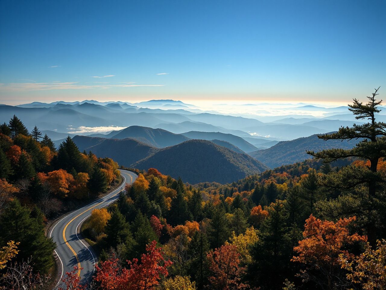
The route runs between Tellico Plains in Tennessee and Robbinsville in North Carolina. From the Tellico River area, the road climbs from about 900 feet above sea level to Haw Knob on the Tennessee-North Carolina state line. Here, elevation exceeds 5,400 feet. The Tennessee part covers roughly 25 miles. The North Carolina side measures about 19 miles.
The road crosses remote terrain connected with the Cherokee National Forest and Nantahala National Forest. That setting explains the ride better than a simple list of curves does. A motorcycle route can be paved, wide, and easy to follow while still leaving a rider far from quick roadside assistance.
The Cherohala Skyway connects Tellico Plains and Robbinsville across high mountain terrain. Both endpoints matter in trip planning. Riders should view the crossing as a complete route, not assuming services will appear between the towns.
Which direction makes sense?
Both directions are practical. The choice depends on the rest of the day, the weather, and where the motorcycle starts with fuel and supplies.
- Start in Tellico Plains when Tennessee lodging, food, or a planned route through the Cherokee National Forest fits the day. The road begins near the lower Tellico River country and climbs toward the high points.
- Start in Robbinsville when the ride is part of a North Carolina loop involving Santeetlah Lake, Nantahala National Forest routes, or the Tail of the Dragon.
- Choose the direction with the safer return plan. A rider facing worsening weather should not select a direction only for a preferred view or corner sequence.
Plan the skyway as an out-and-back only if the return remains practical in case of delays. Otherwise, include it as part of a larger loop, and pick a turnaround point that’s easy to reach. A printed map or offline route copy is helpful because signals can’t be relied on in remote sections.
What the pavement feels like
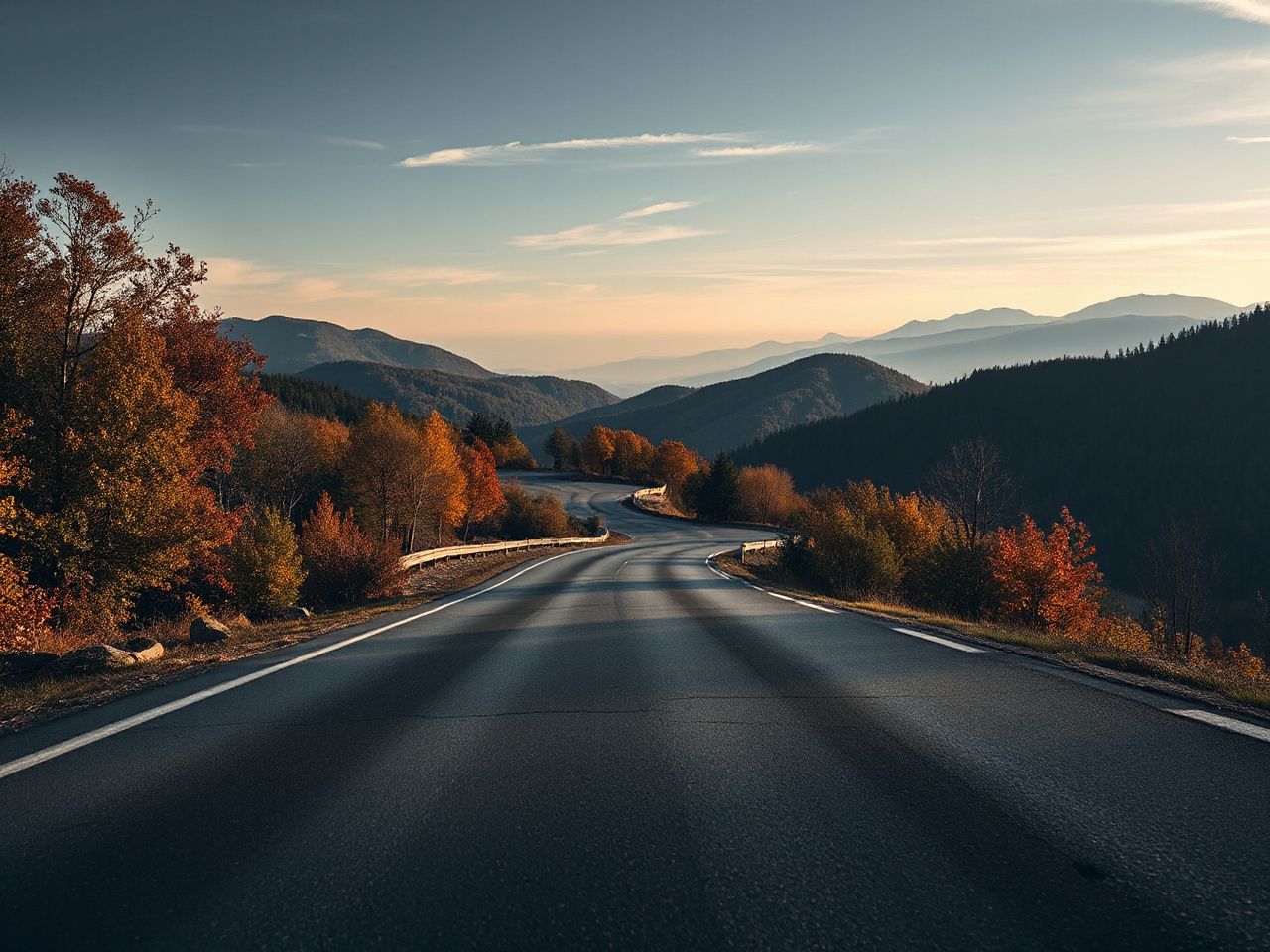
The Cherohala Skyway has a wide, paved, two-lane surface. Grades can reach as steep as 9% on some segments, and elevation changes affect the ride’s feel even when the pavement is smooth enough for normal travel.
Expect curves, changing sightlines, and mountain exposure rather than a repetitive corner pattern. The road has 15 scenic overlooks. Stopping often means the trip will take longer than a straight shot. Shoulders and pullouts aren’t all the same. Some may have limited space, loose gravel, changing pavement, or unexpected traffic.
A paved mountain road still needs a controlled speed and a clear view through each bend. The surface might be good, but gravel or debris can be at the pullout edges. Entry and exit become more important than a dramatic approach.
Plan the ride before entering the remote sections
Fuel, food, water, and phone service
The central planning fact is simple: the route is a scenic mountain road, not a continuous line of motorcycle services. Fuel, food, water, and cellular service should be handled before entering the more remote portions. Do not build a plan around finding a convenient station halfway across.
Start with checking the motorcycle’s fuel level, tire condition, controls, lights, chain or final drive, and luggage security. The inspection details depend on the motorcycle, but the idea is the same everywhere. A small problem near town is just an inconvenience; on a mountain road, it could be the main issue for the day.
- Fill the motorcycle before the remote crossing rather than postponing the decision.
- Carry drinking water and food that can remain available if the ride takes longer than planned.
- Download or print route information before leaving service in case the phone cannot load a map.
- Tell a contact the route and the likely arrival plan, then update that person if the route changes.
- Keep enough daylight and fuel margin for a turnback, detour, or delay caused by weather or debris.
Tellico Plains lodging and services can support planning at the Tennessee end, while Robbinsville provides the North Carolina side of the route. The useful question is not only where a rider sleeps, but also where the motorcycle can be fueled, where water can be obtained, and where a delayed arrival can be communicated.
Cell coverage can change a lot in mountain terrain, so treat your phone as just one way to communicate. A charged phone, a physical map, basic repair skills, and a clear contact plan can help if signals are weak.
Allow time for the road you actually want to ride
A direct trip across the entire skyway takes roughly 2 hours. That figure describes travel across the route, not a relaxed day with overlooks, photographs, water stops, weather checks, and a possible turnaround.
There are 15 overlooks, making natural pauses. But stopping at all of them isn’t necessary, and skipping them all takes away much of the route’s character. Pick a few before leaving, and leave room for unexpected delays. Scheduling the crossing as a tight appointment might make someone rush through fog or debris, and rushing cuts the safety margin needed in remote areas.
Planning the route should include time from lodging, time at overlooks, and any side roads or the trip after Robbinsville or Tellico Plains. A motorcycle day is easier when the skyway is the main focus, not just a short break between fixed plans.
Turnaround and breakdown planning
Choose turnaround points before the ride begins. A legal, visible pullout or a town endpoint is better than an improvised stop near a blind curve, narrow shoulder, or loose surface.
If the motorcycle develops a problem, move only as far as necessary to reach a safer visible location. Check fuel, tire condition, controls, temperature warnings, and whether the motorcycle can stay stable. If continuing might damage the bike or put the rider at risk, stop trying to keep to the original schedule.
For a disabled motorcycle, make the location easy to describe: note the nearest overlook, road direction, visible sign, or junction shown on the map. Stay clear of moving traffic and avoid standing where another rider might mistake a pullout for an open travel lane.
Weather, closures, and scenic stops
Why high elevation changes the ride
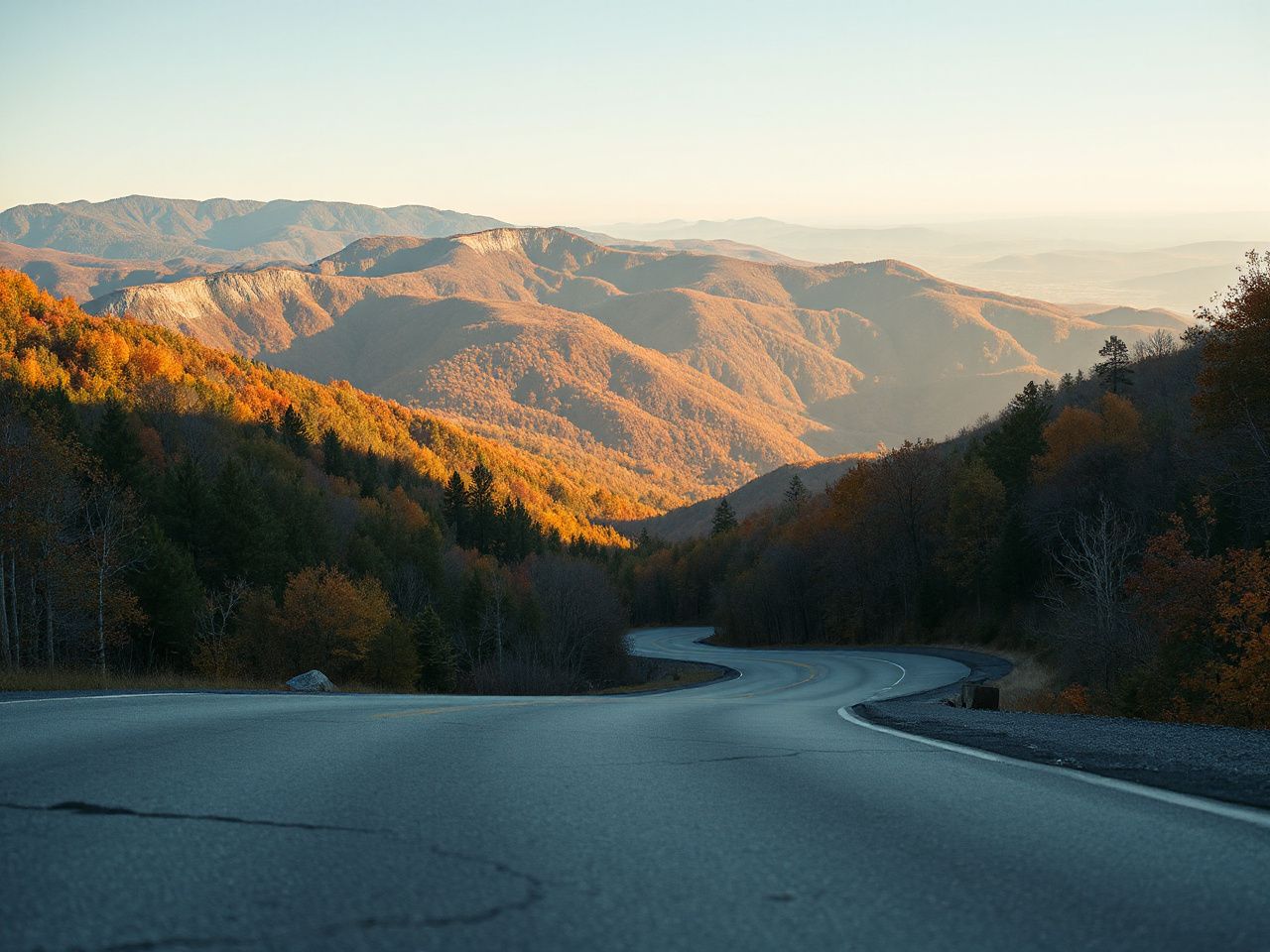
Weather can be pleasant in Tellico Plains or Robbinsville but unpleasant higher on the route. Fog, rain, wind, fallen trees, and cooler conditions can reduce visibility and traction, while a dry lower section might give false confidence about the road ahead.
High elevation changes can make a mountain crossing colder and less visible than its endpoints suggest. A rider should check the forecast for the high route, not just the town where breakfast or lodging is located.
- Fog: Reduce speed enough to preserve stopping distance within the visible road, and reconsider the crossing if the view is shrinking faster than confidence allows.
- Rain: Expect less grip and more reflective glare, especially near painted surfaces or wet leaves.
- Wind: Keep both hands ready and leave room for gusts near exposed ridges and overlooks.
- Fallen trees and debris: Treat a blocked lane or scattered branches as a reason to stop and reassess, not as a challenge to squeeze through.
- Cold: Watch for reduced comfort and slower reactions, particularly after a long descent or an unplanned delay.
The National Weather Service provides official weather information, while the U.S. Forest Service is a helpful starting point for public-land access info. These agencies do not replace a local road-status check but help separate a town forecast from mountain conditions.
Closures and access checks
Road status should be checked before departure because seasonal closures, storm damage, maintenance, fallen trees, and local access conditions can change the route. Look for current notices from transportation agencies, forest offices, and local authorities at both ends of the crossing.
A map showing the road does not guarantee it’s open. Check the status shortly before leaving and again if the weather changes during the day. If the skyway is closed, don’t treat a barricade as a suggestion or assume a motorcycle can pass where larger vehicles can’t.
Road closures can affect the main route, a scenic pullout, or a side road that appears useful on an older map. Measure the opening first. Keep the day’s plan flexible enough to return to town, use a confirmed alternate, or postpone the high section.
Overlooks and nearby stops
Overlooks are part of the route rather than optional decoration. They give places to pause, check the weather, drink water, and reset attention. These stops help prepare for more curves ahead.
Enter each pullout slowly and scan for gravel, uneven pavement, parked vehicles, pedestrians, and motorcycles leaving the area. Position the motorcycle so departure does not require a rushed turn or a blind merge. A passenger should also know that a stop can involve a rough edge, limited space, or traffic moving close by.
Nearby attractions can extend the ride. Bald River Falls has a waterfall height of 100 feet. Huckleberry Knob Trail covers 1.7 miles. Joyce Kilmer Memorial Forest includes a 2-mile trail loop. These stops require their own time, footwear, weather judgment, and parking assessment. They should not be added to a tightly timed crossing.
The Tellico River area, Santeetlah Lake, and routes through the Cherokee and Nantahala national forests can help form a larger day. Every added road creates another place for weather, fatigue, fuel, or closure problems to appear.
Match the route to the rider and the wider loop
Newer riders, passengers, and touring motorcycles
The Cherohala Skyway can suit a newer rider if the rider is comfortable with sustained curves, elevation changes, changing weather, and limited services. The route should not be used as a first lesson in mountain riding. A quieter day with a clear forecast and a conservative schedule gives a newer rider more room to learn. This avoids turning every bend into a deadline.
Passengers need a clear plan for stops, clothing changes, water, and movement during low-speed pullout entries. A passenger who becomes cold, tired, or uncomfortable can change the risk picture as quickly as fog or rain.
Larger touring motorcycles can use a wide, paved, two-lane road. Size does not remove the need to manage turnarounds, loose edges, steep grades, and limited stopping space. Confirm that the motorcycle’s luggage is secure and that the rider can place the machine confidently before choosing a remote crossing.
A newer rider, passenger, or large motorcycle changes the value of margin. You need more time, a larger fuel reserve, and fewer fixed appointments. This makes the route easier to manage.
How it differs from nearby motorcycle roads
The Tail of the Dragon is often paired with the skyway, but they serve different purposes in a trip plan. The Tail of the Dragon is famous for its concentrated cornering experience. The Cherohala Skyway offers long views, high elevation, overlooks, and remote travel. Don’t expect the skyway to deliver the same type of ride as the dragon.
The Foothills Parkway can also be part of a regional loop. Roads near the Cherokee National Forest, Nantahala National Forest, and Santeetlah Lake add different scenery and route options. A dragon-and-skyway loop can be enjoyable, but it increases distance, fuel use, fatigue, and the chances of a closure disrupting the plan.
Choose the skyway for a scenic mountain crossing with planned stops and changing conditions. Pick the concentrated corner road if that’s your specific riding goal. Combining both means having a schedule that still works if one section gets removed.
Lodging, camping, and trip costs
Budget planning should include fuel, food, water, lodging, camping fees if needed, navigation supplies, and a reserve for an unplanned night or route change. Costs vary by season and personal choices. A good plan records likely categories rather than relying on a single total.
Camping near the route can reduce the need to cross the mountains late in the day. Still, camping requires checking access, weather, water, and local rules. Lodging in Tellico Plains or Robbinsville can be a safer endpoint than trying to add another remote section after sunset.
Don’t make a lodging reservation the reason to continue through worsening conditions. A booking costs money, but a mountain emergency is a bigger planning failure.
Common planning errors and a safer checklist
Mistakes that cause avoidable trouble
- Entering with a low fuel level: The rider assumes services will appear along a scenic route. Fill before the remote section.
- Using only live navigation: The rider loses the route when service drops. Save the map or carry a printed route plan.
- Checking only the endpoint forecast: The rider misses fog, wind, rain, or cold at elevation. Check mountain conditions as well as town conditions.
- Riding past a safe turnaround: The rider hopes conditions improve and later finds fewer places to stop. Decide in advance what signs trigger a retreat.
- Confusing the skyway with the Tail of the Dragon: The rider schedules the route as a nonstop corner challenge. Plan for overlooks, exposure, and solitude.
- Ignoring a warning light or handling change: The rider protects the itinerary instead of the motorcycle and rider. Stop, inspect, and choose the least exposed safe option.
A scenic road can turn into a serious logistics problem if fuel, weather, communication, and daylight are treated as separate issues. The Cherohala Skyway needs a plan that stays workable even after a delay.
A practical departure checklist
- Confirm that the road and intended side roads are open.
- Check weather for Tellico Plains, Robbinsville, and the high route.
- Fuel the motorcycle and identify the next confirmed fuel point after the crossing.
- Pack water, food, rain protection, warm layers, basic repair supplies, and a first-aid kit suited to the rider’s needs.
- Save directions offline and carry a paper route reference.
- Inspect tires, controls, lights, luggage, and visible fluid leaks.
- Share the route and an expected arrival window with a contact.
- Set a clear turnaround rule before entering the remote section.
The Federal Highway Administration provides national transportation information, but current local conditions still belong to the agencies responsible for the road and surrounding public land. Use official notices for access decisions and treat third-party map pins as planning aids rather than proof of an open road.
The best Cherohala Skyway motorcycle plan isn’t the one with the most stops or the tightest loop. It’s the plan that still gives the rider a safe choice after a cold front, a fallen tree, a weak signal, a tired passenger, or a disabled motorcycle changes the day.
Frequently Asked Questions
Where does the Cherohala Skyway start and end, and which direction should a motorcycle rider choose?
The route connects Tellico Plains in Tennessee with Robbinsville in North Carolina. Either direction can work, so choose based on lodging, fuel, weather, and the safest return plan. Starting in Tellico Plains puts the rider near the lower Tellico River area before the climb. Starting in Robbinsville can fit a North Carolina loop involving Santeetlah Lake or nearby forest roads.
How long should I allow for the Cherohala Skyway?
A direct crossing takes roughly 2 hours. That doesn’t include overlooks, photos, food, weather checks, delays, or side trips. The route has 15 scenic overlooks. Each stop adds time. Build a flexible day around the crossing rather than scheduling it as a narrow connection between two fixed appointments.
What should I do if the Cherohala Skyway is closed or my motorcycle breaks down?
Check official road and public-land notices before departure because seasonal closures, storm damage, maintenance, and fallen trees can affect access. If the motorcycle fails, move to a safer visible location only if possible. Identify the nearest landmark or direction. Contact assistance, and avoid walking blindly through remote terrain. A saved map, charged phone, water, and a contact who knows the route all matter.