Best Bike Trails in Colorado: Our Top Picks for 2026
Contents
Choosing among the best bike trails in Colorado is three decisions stacked on top of each other: what surface you want under your tires, how high you are willing to ride in your first days at elevation, and whether the trail is open in the month you are traveling. Get the order wrong and you end up on a snowbound pass in May, on clay singletrack that turns to glue after a storm, or gasping at 11,000 feet the morning after a flight.
Two things separate Colorado from most places you have ridden. A large share of its best riding is paved: former railroad grades and highway corridors rebuilt as separated bike paths. The second is altitude. The paved loop around Leadville sits above 10,000 feet, and Summit County’s pathway network tops out above 10,500 feet. That is not a scenic detail; the CDC treats it as a medical planning factor. What follows uses what the managing agencies publish.
Key takeaways
- Colorado’s riding splits in two: long paved rail-trails and canyon paths, and singletrack on public land.
- The CDC says any unacclimatized traveler sleeping at 8,000 feet or higher risks altitude illness, and advises only mild exercise for the first 48 hours.
- The Rio Grande Trail runs 42 miles between Aspen and Glenwood Springs on a former railroad grade, almost entirely paved.
- Summit County’s paved Recpath exceeds 55 miles and ranges from 8,777 to 10,563 feet.
- Desert singletrack near Fruita and Grand Junction is open year-round, which makes it the April and October answer.
Altitude is the first planning decision, not a footnote
The CDC’s Yellow Book states that any unacclimatized traveler proceeding to a sleeping altitude of 8,000 feet or higher, and sometimes lower, is at risk for altitude illness. The cardinal sign of acute mountain sickness is headache, often with loss of appetite, dizziness, fatigue, or nausea, and symptoms typically appear 2 to 12 hours after arrival or after moving higher.
The advice is specific. Avoid going directly from low elevation, under about 4,000 feet, to a sleeping altitude above 9,000 feet in one day. Above roughly 10,000 feet, move your sleeping altitude no more than about 1,600 feet per day. Do only mild exercise for the first 48 hours, and skip alcohol in that window. If symptoms develop, descending 1,000 feet or more usually brings rapid improvement, and descent is mandatory if symptoms worsen despite treatment.
As a riding plan: land in Denver, ride a Front Range path on day one, and save Leadville or Vail Pass for day three or four. Landing at noon and starting a 1,500-foot climb at 9,000 feet that afternoon is exactly what the guidance warns against.
The paved trails that make Colorado unusually easy to ride
Rio Grande Trail, Aspen to Glenwood Springs. Pitkin County describes a 42-mile route on the old Denver & Rio Grande Western railroad grade, 20 miles of it between Emma and the Aspen Post Office under county management. The grade is paved except for a roughly two-mile crusher-fine stretch below Stein Park outside Aspen. RFTA, which manages the middle section, describes a path 8 to 10 feet wide with soft shoulders. Class 1 and Class 2 e-bikes are allowed on RFTA’s section and Class 1 only above Basalt, the speed limit is 20 mph, and the segment between Rock Bottom Ranch and Catherine Bridge closes for wildlife from November 30 to April 30, with a signed detour.
Summit County Recreational Pathway. The county reports more than 38 miles it maintains plus another 17 maintained by Breckenridge, Dillon, Frisco, Silverthorne, and Keystone, for a paved network of more than 55 miles linking those towns. Elevation runs from 8,777 to 10,563 feet, and the county singles out the 1,500-foot climb to Vail Pass as the hardest stretch. More than 200,000 trips are recorded between May and October. Class 1 e-bikes only. The Town of Frisco flags two set-piece routes off the network: an 18-mile Dillon Reservoir loop with about 1,100 feet of climbing, and the 79-mile, 5,900-foot Copper Triangle.
Vail Pass and Tenmile Canyon. The paved corridor between Vail and Copper Mountain is a National Recreation Trail, designated in 1980, listed at 21 miles out and back and managed by White River National Forest. It runs from Gore Creek Campground to Copper Mountain and feeds into the Summit County pathway, which is why the Vail-to-Frisco crossing is the classic day out.
Mineral Belt Trail, Leadville. An 11.6-mile paved loop around Leadville’s historic mining district, built between 1995 and 2000 and sitting above 10,000 feet, with interpretive signs on the 1880s silver operations. It is ADA accessible, Class I and II e-bikes are permitted, and in winter it is groomed for nordic skiing, snowshoeing, and fat biking. The main trailhead is Dutch Henry, south of town off Highway 24.
Front Range acclimatization rides. The City of Boulder lists a 5.5-mile multi-use path from Boulder Canyon west to Stazio Ballfields just past 55th Street. South of Denver, Parker maintains an 8.11-mile concrete section of the Cherry Creek Regional Trail, 10 feet wide with a separate unpaved equestrian trail alongside, from Norton Farms Open Space to Stroh Ranch Park. Either is a sound day-one ride before you go high.
Glenwood Canyon recreation path. CDOT maintains a dedicated path for walking, biking, and jogging alongside I-70 through the canyon, tied to the No Name, Grizzly Creek, Hanging Lake, and Bair Ranch rest areas. It opens for the summer season typically in late May, and CDOT warns that high runoff can close sections on short notice for an undetermined length of time. Check COtrip.org before you drive.
| Trail | Surface | Length | Altitude factor |
|---|---|---|---|
| Rio Grande Trail | Paved, 2 miles crusher fine | 42 miles | Railroad grade, no sustained climbing |
| Summit County Recpath | Paved | 55+ mile network | High: 8,777 to 10,563 feet |
| Mineral Belt Trail | Paved | 11.6-mile loop | Above 10,000 feet |
| Boulder Creek Path | Paved multi-use | 5.5 miles | Low: acclimatization day |
| 18 Road | Desert singletrack | 20+ miles | Low: western desert |
| Monarch Crest | Singletrack and dirt road | About 11 miles of CDT | High point near 11,960 feet |
Singletrack: desert in the shoulder seasons, alpine in late summer
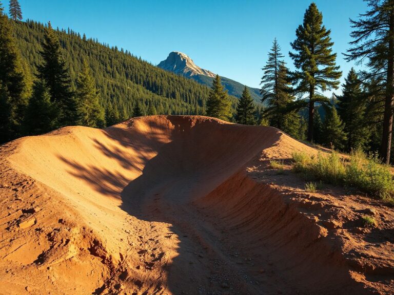
Two BLM systems carry the shoulder season. The 18 Road trails in the North Fruita Desert Special Recreation Management Area hold more than 20 miles of singletrack with 1,800-plus feet of gain and loss, built around flow features such as rollers, berms, and tabletops, beginner through advanced. BLM lists the area as open year-round with no fee to ride, seven miles north of Fruita on 18 Road from I-70 exit 19. Camping is at the North Fruita Desert Campground, booked through Recreation.gov, 14-day limit.
Closer to Grand Junction, Lunch Loops has more than 20 miles rated more difficult to very difficult, with over 2,000 feet of combined gain and loss, off Monument Road about 1.8 miles from Highway 340. Free Lunch and Pucker Up are downhill-only, mountain bikes only. Also free and open year-round.
For high alpine singletrack, the Monarch Crest ride follows Continental Divide National Scenic Trail #531 south from Monarch Pass. Salida’s visitor information describes roughly 11 miles of the Continental Divide Trail starting near 11,315 feet with a high point of about 11,960 feet, which makes a 28-mile day of four to five hours for intermediate-to-advanced riders; the Rainbow Trail adds a further 29 miles beyond it, on a mix of singletrack, four-wheel-drive road, and graded road. The trailhead is roughly 18 miles west of Poncha Springs on US 50, and most riders shuttle. For less mountain, the same source lists a nine-mile round trip on the S Mountain and Tenderfoot trails with about 610 feet of gain.
Pro tip
Book your first two nights at the lowest elevation your itinerary allows and ride a valley path on arrival day. The CDC’s mild-exercise-for-48-hours advice costs you nothing if you schedule the low rides first, and it protects the high day you traveled for.
Season, mud, and closures
Paved high-country paths follow the snow. Summit County’s use figures cover May through October, and CDOT opens the Glenwood Canyon path around late May. Leadville’s Mineral Belt Trail is the exception: it stays in use all winter because it is groomed for skiing and fat biking rather than plowed for road bikes.
On dirt the constraint is soil, not snow. BLM asks riders to check conditions before heading out and to find an alternative if the destination is muddy, and warns against riding around wet sections, which tramples trailside vegetation and widens the trail. Separately, the Grand Junction Field Office runs annual closures from December 1 to May 1 on listed roads and areas in Mesa, Delta, and Montrose counties to reduce stress on wintering wildlife. Those apply to motorized and mechanized use, which includes bicycles, while hiking and horseback riding stay open.
Common mistake
Assuming “open year-round” means “rideable today.” 18 Road and Lunch Loops have no seasonal gate, but a nearby area may sit under a December-to-May wildlife closure that covers bikes. Call the Grand Junction Field Office at 970-244-3000 before committing to the drive.
How to verify a trail before you drive to it
Every trail above has a named manager that publishes conditions. Glenwood Canyon is CDOT, via COtrip.org, with Region 3 at 1-970-243-2368. The Rio Grande Trail is split three ways, which is why the e-bike rules change midway: the City of Glenwood Springs to 23rd Street, RFTA to Emma Road in Basalt, and Pitkin County Open Space and Trails from Emma to Aspen. 18 Road and Lunch Loops are the BLM Grand Junction Field Office; Vail Pass and Tenmile Canyon are White River National Forest.
Frequently asked questions
What is the highest paved bike trail in Colorado?
Leadville’s Mineral Belt Trail is the standout, an 11.6-mile paved loop above 10,000 feet. Summit County’s network reaches 10,563 feet, so the top of the Vail Pass climb is comparable.
How long should I acclimatize before a high-altitude ride?
The CDC advises against jumping from under 4,000 feet to a sleeping altitude above 9,000 feet in one day, says to move sleeping altitude no more than about 1,600 feet per day once high, and to keep to mild exercise for the first 48 hours. Two easy low-elevation days is the simplest way to comply.
Are e-bikes allowed on Colorado’s paved trails?
It depends on the manager. Summit County’s Recpath allows Class 1 only. The Rio Grande Trail allows Class 1 and 2 from Glenwood Springs to Basalt, Class 1 only from Basalt to Aspen. The Mineral Belt Trail permits Class I and II. Check the agency page rather than assuming a statewide rule.
When do Colorado bike trails open for the season?
High-country paved paths come into use from May onward; Summit County counts its trips between May and October, and CDOT typically opens the Glenwood Canyon path in late May. Alpine singletrack such as the Monarch Crest corridor holds snow considerably later.
Where can I ride in Colorado in March or November?
The western desert. BLM lists both 18 Road near Fruita and Lunch Loops near Grand Junction as open year-round with no fee. Ride them dry, and check for nearby wildlife closures running December 1 to May 1.
Is the Rio Grande Trail suitable for beginners?
Largely yes: a former railroad grade, paved except for about two miles of crusher fine near Aspen, 8 to 10 feet wide, and protected from traffic except at intersections. The caution is the winter wildlife closure between Rock Bottom Ranch and Catherine Bridge, which is signed with a detour.